Project Blue Book File on Tremonton Film, Utah, 1952
DOW-UAP-D102 · page 59 of 156
Text
A machine read this text from the scan. When the text and the image disagree, the image is right.
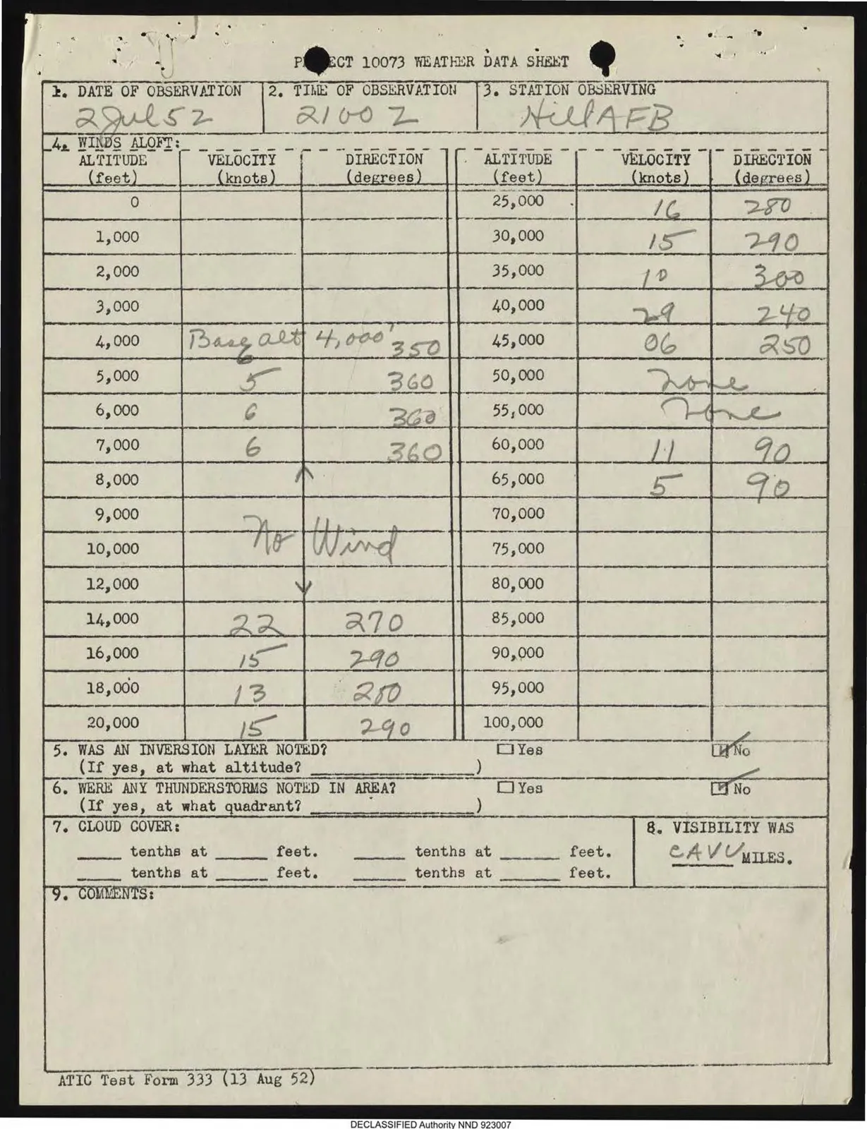
PROJECT 10073 WEATHER DATA SHEET

1. DATE OF OBSERVATION

2 Jul 52

2. TIME OF OBSERVATION

2100 Z

3. STATION OBSERVING

Hill AFB

4. WINDS ALOFT:

ALTITUDE (feet) | VELOCITY (knots) | DIRECTION (degrees) | ALTITUDE (feet) | VELOCITY (knots) | DIRECTION (degrees)
0 |  |  | 25,000 | 16 | 280
1,000 |  |  | 30,000 | 15 | 290
2,000 |  |  | 35,000 | 10 | 300
3,000 |  |  | 40,000 | 29 | 240
4,000 | Basalt 4,000' 350 | 360 | 45,000 | 06 | 250
5,000 | 5 | 360 | 50,000 | None |
6,000 | 6 | 360 | 55,000 | None |
7,000 | 6 | 360 | 60,000 | 11 | 90
8,000 | ^ |  | 65,000 | 5 | 90
9,000 | No Wind |  | 70,000 |  |
10,000 |  |  | 75,000 |  |
12,000 | Y |  | 80,000 |  |
14,000 | 22 | 270 | 85,000 |  |
16,000 | 15 | 290 | 90,000 |  |
18,000 | 13 | 280 | 95,000 |  |
20,000 | 15 | 290 | 100,000 |  |

5. WAS AN INVERSION LAYER NOTED?

(If yes, at what altitude?)

☐ Yes

☑ No

6. WERE ANY THUNDERSTORMS NOTED IN AREA?

(If yes, at what quadrant?)

☐ Yes

☑ No

7. CLOUD COVER:

__ tenths at __ feet.

__ tenths at __ feet.

__ tenths at __ feet.

__ tenths at __ feet.

8. VISIBILITY WAS

CAVU MILES.

9. COMMENTS:

ATIC Test Form 333 (13 Aug 52)

DECLASSIFIED Authority NND 923007